The drive from Sanborn, WI to Menomonee Falls, WI covers 321.5 miles and takes about 6h 42m behind the wheel.
This route is realistic as a one-day drive if you keep your stops efficient.
The route leans on I 41, State Highway 13, US 10 for much of the mileage,
and the overall profile is highway-focused drive.
The longest uninterrupted segment is about 67.4 miles on I 41.
At current regular gas prices, budget about $50.26 one way before food or hotel costs.
Trip Pace
Same-day drive is realistic
A same-day return is possible, but it will make for a full day on the road.
Break Rhythm
1 planned break
Plan on a short reset every 3 to 4 hours to stay fresh behind the wheel.
Midpoint
160.8 miles from Sanborn, WI
A natural place for your longest stop of the day
, about 3h 39m into the drive
.
Who Is This Route For?
Weekend Trip
Doable as a same-day drive at 6h 42m. Total distance: 321.5 miles.
Family Friendly
Moderate complexity with 1 natural rest stops along the way.
Solo Traveler
6h 42m drive, plan rest stops for pacing.
Drive Character
This is a 6h 42m highway drive covering 321.5 miles, with most of the trip on I 41 and State Highway 13. The longest continuous stretch is about 67.4 miles on I 41.
Most of the miles stay on highways, which makes pacing and fuel planning easier than turn-by-turn city driving.
There are about 34 navigation steps in the underlying route data, so the final approach matters more than the middle miles.
I 41 is the longest continuous segment at about 67.4 miles.
How Hard Is This Drive?
This is a straightforward highway drive that stays mostly on I 41 and State Highway 13. This route has several spots where lane changes, forks, or exits need your full attention. The trickiest moment comes around 111.2 miles in.
Driving Effort9/10
High effort - long or complex enough to need steady focus all day
Balances navigation complexity with total wheel time.
This is a demanding drive. With 12 significant decision points across 321.5 miles, you will need to stay alert - especially through interchange areas and urban stretches. Consider splitting it into segments if you are not comfortable with fast highway navigation.
Where does it get tricky?
The main spots that need attention: at 111.2 miles: Exit ramp - move to the correct lane early. Lane positioning matters here; at 157.8 miles (I 39; US 51): Highway fork - watch signs carefully. Multiple destination signs - pick the right one; at 188.1 miles (US 10): Highway fork - watch signs carefully. Lane positioning matters here. Multiple destination signs - pick the right one.
Critical Maneuvers
5 of 12 key points
These are the spots where you need to pay the most attention. Preview them before you drive.
7
111.2 mi into trip|~2h 42m in
Take the exit
Exit ramp - move to the correct lane early. Lane positioning matters here
Use the right lane.
6
157.8 mi into trip|~3h 36m in|I 39; US 51
Keep slight left at fork onto I 39; US 51 toward I 39 South, US 51 South: Stevens Point, Madison
Highway fork - watch signs carefully. Multiple destination signs - pick the right one
Toward I 39 South, US 51 South: Stevens Point,...
8
188.1 mi into trip|~4h 9m in|US 10
Keep slight right at fork onto US 10 toward US 10 East: Appleton, Waupaca
Highway fork - watch signs carefully. Lane positioning matters here. Multiple destination signs - pick the right one
Use the straight / slight right lanes.
Toward US 10 East: Appleton, Waupaca
8
239 mi into trip|~5h 10m in|US 45
Keep slight right at fork onto US 45 toward US 45 South: Oshkosh
Highway fork - watch signs carefully. Lane positioning matters here
Use the slight left / slight right lanes.
Exit 276
Toward US 45 South: Oshkosh
7
319.9 mi into trip|~6h 38m in
Take the exit toward CTH Q: County Line Road
Exit ramp - move to the correct lane early. Lane positioning matters here
Use the slight right lane.
Exit 52
Toward CTH Q: County Line Road
Towns Mentioned on Route Signs
Based on OSRM destination-sign hints, not a full list of every settlement the road passes.
Between Sanborn, WI and Menomonee Falls, WI, road signs point toward Madison, Waupaca and Appleton.
Madison
157.8 mi in|~3h 36m|via I 39; US 51
Waupaca
187.7 mi in|~4h 8m|via US 10; WI 66
Appleton
187.7 mi in|~4h 8m|via US 10; WI 66
Main Roads
Road
Distance
Duration
I 41
67.4 mi
1h 12m
State Highway 13
65.2 mi
1h 29m
US 10
51.3 mi
1h 1m
US 51
46.3 mi
53m
US 8
32.2 mi
45m
I 39
29.8 mi
32m
US 45
12.3 mi
14m
State Highway 112
3.2 mi
4m
Longest stretch:
I 41
— 67.4 mi, about 1h 12m
Turn-by-Turn Driving Directions
Step-by-step road directions between Sanborn, WI and Menomonee Falls, WI.
1
Start on CTH E
0.7 mi·1 min·County Road E
2
Turn right onto Petrin Road
258 ft·13 sec·Petrin Road
3
Turn straight onto WI 112
3.2 mi·4 min·State Highway 112
4
Turn right onto WI 13
13 mi·17 min·State Highway 13
5
Continue on WI 13
1.6 mi·3 min·North Main Street
6
Continue on WI 13; WI 77
14 mi·19 min·State Highway 13
7
Continue on WI 13
0.6 mi·1 min·West Broadway
8
Continue on WI 13
8.9 mi·12 min·State Highway 13
9
Continue on WI 13
1.1 mi·2 min·North 5th Street
10
Continue on WI 13
4.6 mi·6 min·State Highway 13
11
Continue on WI 13
3.0 mi·6 min·4th Avenue North
Use the straight / right lanes.
12
Continue on WI 13
372 ft·5 sec·4th Ave S
13
Continue on WI 13
2.1 mi·2 min·State Highway 13
14
Continue on WI 13
0.8 mi·1 min·Flambeau Avenue
15
Continue on WI 13
12 mi·16 min·State Highway 13
16
Continue on WI 13
2.4 mi·5 min·North Lake Avenue
Use the straight / right lanes.
17
Continue on WI 13
11 mi·14 min·State Highway 13
18
Turn straight
0.2 mi·46 sec
19
Turn left onto US 8
32 mi·45 min·US 8
Use the straight lane.
20
Take the exit
0.4 mi·51 sec
Use the right lane.
21
Merge onto US 51
46 mi·53 min·US 51
Use the straight lane.
22
Keep slight left at fork onto I 39; US 51
22 mi·24 min·I 39; US 51
Toward I 39 South, US 51 South: Stevens Point, Madison
23
Continue on I 39; US 10; US 51
7.4 mi·7 min·I 39; US 10; US 51
24
Take the exit onto US 10; WI 66
0.4 mi·57 sec·US 10; WI 66
Exit 158Toward US 10 East, WI 66 West: Stevens Point, Waupaca, Appleton
25
Keep slight right at fork onto US 10
51 mi·1 hr·US 10
Toward US 10 East: Appleton, WaupacaUse the straight / slight right lanes.
26
Keep slight right at fork onto US 45
12 mi·14 min·US 45
Exit 276Toward US 45 South: OshkoshUse the slight left / slight right lanes.
27
Take the exit
1.1 mi·1 min
Toward I 41 South: Milwaukee
28
Merge onto I 41; US 41
67 mi·1 hr 12 min·I 41; US 41
Use the straight / slight right lanes.
29
Take the exit
0.2 mi·20 sec
Exit 52Toward CTH Q: County Line RoadUse the slight right lane.
30
Turn right onto CTH Q
0.1 mi·18 sec·County Line Road
31
Turn slight left
386 ft·19 sec
32
Turn left onto River Crest Drive
0.4 mi·1 min·River Crest Drive
33
Turn left onto WI 175
0.8 mi·2 min·Appleton Avenue
34
Arrive at destination
WI 175
Trip Plan
Morning Departure
Start early — leave by 6-7 AM to arrive at a reasonable hour.
Evening Departure
This is a long drive — plan for a morning departure or consider splitting it into two days.
You can normally do this drive in one day.
Plan roughly 1 meaningful break for fuel, food, and rest.
The halfway point lands around 160.8 miles from Sanborn, WI, or about 3h 39m into the drive.
The longest continuous stretch on this route runs about 67.4 miles.
This is a comfortable same-day trip.
Departure
Before you leave
Start with fuel, water, and navigation already sorted so the first hour feels easy.
First stop
Around 71 miles or 1h 45m in
Use this first pause for coffee, a restroom break, and a quick traffic check ahead.
Halfway reset
Around 160.8 miles or 3h 39m in
This is the best place for your longest stop, a real meal, and a full fuel check.
Final approach
Final hour starts around 5h 37m
Traffic, exits, and arrival timing usually matter more near Menomonee Falls, WI than in the middle of the route.
Before You Leave
+
Open the route before leaving Sanborn, WI so your first major turns are already loaded.
+
Leave with enough water and a charging cable within reach, not packed away.
+
Check your fuel range against the first long segment, especially if you are starting outside city service areas.
Day 1
Settle into the route from Sanborn, WI
This is one driving day of about 321.5 miles and 6h 42m.
Your first comfortable stop window is around 71 miles from Sanborn, WI.
This route can stay practical as a one-day drive if traffic stays reasonable.
Plan about 1 real break rather than only quick fuel stops.
The longest stretch is on I 41 for about 67.4 miles.
Where to Stop
Rest stops, refuel points, and overnight suggestions along this route.
Halfway Point
Midpoint
About 160.8 mi from Sanborn, WI
· 3h 39m into the drive
The midpoint is around 160.8 miles from Sanborn, WI, which is a good place for a longer meal and fuel stop.
Before the longest stretch
Fuel check
Top up before I 41 if your tank is already low. That segment runs about 67.4 miles.
Arriving in Menomonee Falls, WI
The final approach into Menomonee Falls, WI usually feels slower than the middle of the drive, so avoid planning your tightest schedule at the very end.
Try to arrive with enough fuel left to skip an immediate station stop unless you already know the area around Menomonee Falls, WI.
These stop ideas are pacing suggestions — the exact town or exit can change with traffic, hotel plans, and fuel range.
National Parks Near This Route
Worth a detour if your schedule allows.
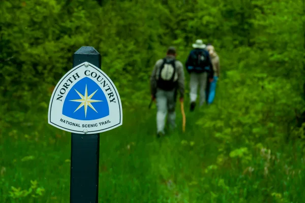
North Country National Scenic Trail
National Scenic Trail
Come to the North Country. Trek the hills and valleys. Stand on the shores of lakes & streams from glaciers 10,000 years before. Clear-flowing water, red/gold of autumn, a fairyland of snow, open prai...
6 mi from route
~14 min detour
Free
near mile 11.1
Station data from NREL Alternative Fuel Stations database.
Driving Electric?
About $34 in charging
· 1 stop
· 66% less CO2
Vehicle Type
kWh
Stops
DC Fast
Home Charge
Average EV
96.5
1
$33.76
$15.43
Efficient EV
80.4
0
$28.13
$12.86
EV Truck/SUV
128.6
1
$45.01
$20.58
Gas CO2
112 kg
EV CO2
38 kg (66% less)
Plan for 1 charging stop. A 30-minute DC fast charge mid-route should be enough to complete the trip comfortably.
DC fast charging avg $0.35/kWh. Home charging avg $0.16/kWh. US grid CO2: 0.39 kg/kWh.
Travel Intel
Current conditions at both ends of the drive.
Forecast as of Apr 16, 2026
Origin
Sanborn, WI
Morning
in Sanborn on Friday
Local time
6:11 AM
CDT
Current temp
60°F
Unavailable
Live forecast
Destination
Menomonee Falls, WI
Morning
in Menomonee Falls on Friday
Local time
6:11 AM
CDT
Current temp
62°F
Unavailable
Live forecast
Seasonal Notes
Summer travel usually means heavier construction, hotter rest stops, and busier weekend traffic around major cities.
Winter travel shortens daylight, so a route that looks manageable on paper can feel much longer after dark.
Holiday weekends tend to make both departure and arrival windows slower than the raw route time suggests.
Time zone
Same local time
Origin and destination are on the same clock, so arrival timing is easier to judge at a glance.
Temperature spread
2 degrees warmer at arrival
A meaningful temperature swing is a good cue to rethink layers, water, and how soon you want to arrive.
Road read
6h 42m on the road
Start early — leave by 6-7 AM to arrive at a reasonable hour.
Weather data from the National Weather Service. Conditions may change; check closer to your travel date.
Frequently Asked Questions
The drive from Sanborn, WI to Menomonee Falls, WI covers 321.5 miles and takes about 6h 42m without stops. Add 15-30 minutes for a fuel or rest stop on longer drives.
The main roads are I 41, State Highway 13, US 10. Most of the drive stays on highways, so watch for ramps and exits.
This is a comfortable same-day trip.
The midpoint is about 160.8 miles from Sanborn, WI. Look for rest areas, gas stations, or food options near the halfway mark.
At current regular gas prices, expect to spend about $50.26 one way. This estimate uses 25.4 MPG — your actual cost will vary with your vehicle's fuel efficiency and current gas prices.
Start early — leave by 6-7 AM to arrive at a reasonable hour. This is a long drive — plan for a morning departure or consider splitting it into two days.
Plan about 1 meaningful break for fuel, food, or rest. Plan on a short reset every 3 to 4 hours to stay fresh behind the wheel.
This is a demanding drive. With 12 significant decision points across 321.5 miles, you will need to stay alert - especially through interchange areas and urban stretches. Consider splitting it into segments if you are not comfortable with fast highway navigation.
The main spots that need attention: at 111.2 miles: Exit ramp - move to the correct lane early. Lane positioning matters here; at 157.8 miles (I 39; US 51): Highway fork - watch signs carefully. Multiple destination signs - pick the right one; at 188.1 miles (US 10): Highway fork - watch signs carefully. Lane positioning matters here. Multiple destination signs - pick the right one.
Between Sanborn, WI and Menomonee Falls, WI, road signs point toward Madison, Waupaca and Appleton.
How this page is built
Compiled and maintained by the Trip.ovh planning team at COD Solutions Oy (Helsinki). Each route is built from authoritative open government and mapping datasets rather than crowdsourced reviews. Distances and geometry come from
OSRM
over
OpenStreetMap.
Fuel cost uses
EIA
weekly regional averages.
EV charging comes from the
NREL Alternative Fuels
dataset.
National park proximity is from the
NPS API.
Pages are published only after passing our data-quality checks; our
methodology page
documents refresh cadence, editorial standards, and known limitations.