The drive from Spokane Valley, WA to Buckley, WA covers 293.2 miles and takes about 5h 39m behind the wheel.
This route is realistic as a one-day drive if you keep your stops efficient.
The route leans on I 90, Spokane Valley Freeway, State Route 18 for much of the mileage,
and the overall profile is highway-focused drive.
The longest uninterrupted segment is about 252 miles on I 90.
At current regular gas prices, budget about $61.36 one way before food or hotel costs.
Trip Pace
Same-day drive is realistic
A same-day return is possible, but it will make for a full day on the road.
Break Rhythm
1 planned break
Plan on a short reset every 3 to 4 hours to stay fresh behind the wheel.
Midpoint
146.6 miles from Spokane Valley, WA
A natural place for your longest stop of the day
, about 2h 41m into the drive
.
Who Is This Route For?
Weekend Trip
Doable as a same-day drive at 5h 39m. Total distance: 293.2 miles.
Family Friendly
Moderate complexity with 1 natural rest stops along the way.
Solo Traveler
5h 39m drive, comfortable solo distance.
First-Time Driver
Mostly highway driving (92%). Some complex stretches to watch for.
Drive Character
This is a 5h 39m highway drive covering 293.2 miles, with most of the trip on I 90 and Spokane Valley Freeway. The longest continuous stretch is about 252 miles on I 90.
Most of the miles stay on highways, which makes pacing and fuel planning easier than turn-by-turn city driving.
There are about 31 navigation steps in the underlying route data, so the final approach matters more than the middle miles.
I 90 is the longest continuous segment at about 252 miles.
How Hard Is This Drive?
This is a straightforward highway drive that stays mostly on I 90 and Spokane Valley Freeway. This route has several spots where lane changes, forks, or exits need your full attention. The trickiest moment comes around 0.2 miles in near East Montgomery Avenue.
Driving Effort8/10
Demanding - plan breaks and stay ahead of the key maneuvers
Balances navigation complexity with total wheel time.
This is a demanding drive. With 18 significant decision points across 293.2 miles, you will need to stay alert - especially through interchange areas and urban stretches. Consider splitting it into segments if you are not comfortable with fast highway navigation.
Where does it get tricky?
The main spots that need attention: at 0.2 miles (East Montgomery Avenue): Lane positioning matters here; at 68.4 miles (I 90): Highway fork - watch signs carefully. Lane positioning matters here; at 263.8 miles: Exit ramp - move to the correct lane early. Lane positioning matters here.
Critical Maneuvers
5 of 18 key points
These are the spots where you need to pay the most attention. Preview them before you drive.
7
0.2 mi into trip|~0m in|East Montgomery Avenue
Turn left onto East Montgomery Avenue
Lane positioning matters here
Use the left lane.
6
68.4 mi into trip|~1h 16m in|I 90
Keep slight left at fork onto I 90
Highway fork - watch signs carefully. Lane positioning matters here
Use the straight / slight right lanes.
7
263.8 mi into trip|~4h 48m in
Take the exit toward WA 18 West: Auburn
Exit ramp - move to the correct lane early. Lane positioning matters here
Use the slight right lane.
Exit 25
Toward WA 18 West: Auburn
9
264 mi into trip|~4h 48m in
Keep slight left at fork toward SR 18 west, Snoqualmie Parkway: Auburn, Tacoma
Highway fork - watch signs carefully. Lane positioning matters here. Multiple destination signs - pick the right one
Use the straight / left / right lanes.
Toward SR 18 west, Snoqualmie Parkway: Auburn,...
7
271.3 mi into trip|~4h 58m in
Take the exit toward Issaquah, Hobart
Exit ramp - move to the correct lane early. Lane positioning matters here. Multiple destination signs - pick the right one
Use the straight / slight right lanes.
Toward Issaquah, Hobart
Towns Mentioned on Route Signs
Based on OSRM destination-sign hints, not a full list of every settlement the road passes.
Between Spokane Valley, WA and Buckley, WA, road signs point toward Snoqualmie Parkway: Auburn, Tacoma, Issaquah and Hobart.
Snoqualmie Parkway: Auburn
264 mi in|~4h 48m
Tacoma
264 mi in|~4h 48m
Issaquah
271.3 mi in|~4h 58m
Hobart
271.3 mi in|~4h 58m
Main Roads
Road
Distance
Duration
I 90
252 mi
4h 32m
Spokane Valley Freeway
11.3 mi
14m
State Route 18
6.8 mi
9m
Enumclaw-Black Diamond Road
3.7 mi
5m
276th Avenue Southeast
3.4 mi
6m
Enumclaw Buckley Road
2.7 mi
5m
264th Avenue Southeast
2.5 mi
4m
Landsburg Road Southeast
2.3 mi
4m
Longest stretch:
I 90
— 252 mi, about 4h 32m
Turn-by-Turn Driving Directions
Step-by-step road directions between Spokane Valley, WA and Buckley, WA.
1
Start on WA 27
0.2 mi·27 sec·North Pines Road
Use the left lane.
2
Turn left onto East Montgomery Avenue
155 ft·6 sec·East Montgomery Avenue
Use the left lane.
3
Take the ramp
0.3 mi·42 sec
4
Merge onto I 90
11 mi·14 min·Spokane Valley Freeway
5
Keep slight left at fork onto I 90; US 395
57 mi·1 hr·I 90; US 395
6
Keep slight left at fork onto I 90
195 mi·3 hr 31 min·I 90
Use the straight / slight right lanes.
7
Take the exit
0.2 mi·30 sec
Exit 25Toward WA 18 West: AuburnUse the slight right lane.
8
Keep slight left at fork
448 ft·13 sec
Toward SR 18 west, Snoqualmie Parkway: Auburn, TacomaUse the straight / left / right lanes.
9
Merge onto WA 18
0.3 mi·25 sec·Snoqualmie Parkway
10
Continue on WA 18
6.8 mi·9 min·State Route 18
11
Take the exit
0.5 mi·1 min
Toward Issaquah, HobartUse the straight / slight right lanes.
12
Turn left onto Issaquah Hobart Road Southeast
0.3 mi·32 sec·Issaquah Hobart Road Southeast
Use the straight / left lanes.
13
Continue on 276th Avenue Southeast
3.4 mi·6 min·276th Avenue Southeast
14
Continue on Landsburg Road Southeast
2.3 mi·4 min·Landsburg Road Southeast
15
Continue on Southeast Ravensdale Way
0.9 mi·1 min·Southeast Ravensdale Way
16
Continue on Black Diamond-Ravensdale Road Southeast
The midpoint is around 146.6 miles from Spokane Valley, WA, which is a good place for a longer meal and fuel stop.
Arriving in Buckley, WA
The final approach into Buckley, WA usually feels slower than the middle of the drive, so avoid planning your tightest schedule at the very end.
Try to arrive with enough fuel left to skip an immediate station stop unless you already know the area around Buckley, WA.
After long uninterrupted mileage, take five minutes before the last urban segment to reset and refocus on exits, merges, and city traffic.
These stop ideas are pacing suggestions — the exact town or exit can change with traffic, hotel plans, and fuel range.
National Parks Near This Route
Worth a detour if your schedule allows.
Klondike Gold Rush - Seattle Unit National Historical Park
National Historical Park
Seattle flourished during and after the Klondike Gold Rush. Merchants supplied people from around the world passing through this port city on their way to a remarkable adventure in the Yukon Territory...
21 mi from route
~52 min detour
Free
near mile 273
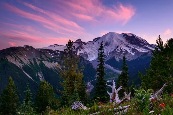
Ascending to 14,410 feet above sea level, Mount Rainier stands as an icon in the Washington landscape. An active volcano, Mount Rainier is the most glaciated peak in the contiguous U.S.A., spawning fi...
26 mi from route
~65 min detour
$30
near mile 293.2
Park data from the National Park Service API. Alerts update every 2 hours.
Fuel & Cost
Regular Gas
$61.36 one way
$122.73 round trip
$5.32/gal25.4 MPG avg103 kg CO2
Fuel Type
$/gal
One Way
Round Trip
midgrade
$5.58
$64.35
$128.71
premium
$5.77
$66.58
$133.16
diesel
$5.61
$64.73
$129.47
No toll roads detected on this route.
Estimated Trip Cost (one way, 1 person)
Fuel
$61
Meals
$25–$50
Total
$86–$111
Rough estimate based on US averages. Hotel $80–$140/night, meals $25–$50/day.
Estimated CO2 emission: 102.6 kg one way.
Prices: EIA weekly data, 2026-04-13.
Driving Electric?
About $31 in charging
· 1 stop
· 67% less CO2
Vehicle Type
kWh
Stops
DC Fast
Home Charge
Average EV
88
1
$30.79
$14.07
Efficient EV
73.3
0
$25.65
$11.73
EV Truck/SUV
117.3
1
$41.05
$18.76
Gas CO2
103 kg
EV CO2
34 kg (67% less)
Plan for 1 charging stop. A 30-minute DC fast charge mid-route should be enough to complete the trip comfortably.
DC fast charging avg $0.35/kWh. Home charging avg $0.16/kWh. US grid CO2: 0.39 kg/kWh.
Travel Intel
Current conditions at both ends of the drive.
Forecast as of Apr 15, 2026
Origin
Spokane Valley, WA
Afternoon
in Spokane Valley on Friday
Local time
1:39 PM
PDT
Current temp
45°F
Unavailable
Live forecast
Destination
Buckley, WA
Afternoon
in Buckley on Friday
Local time
1:39 PM
PDT
Current temp
65°F
Unavailable
Live forecast
Seasonal Notes
Summer travel usually means heavier construction, hotter rest stops, and busier weekend traffic around major cities.
Winter travel shortens daylight, so a route that looks manageable on paper can feel much longer after dark.
Holiday weekends tend to make both departure and arrival windows slower than the raw route time suggests.
Time zone
Same local time
Origin and destination are on the same clock, so arrival timing is easier to judge at a glance.
Temperature spread
20 degrees warmer at arrival
A meaningful temperature swing is a good cue to rethink layers, water, and how soon you want to arrive.
Road read
5h 39m on the road
An early start around 7-8 AM gets you there with plenty of daylight left.
Weather data from the National Weather Service. Conditions may change; check closer to your travel date.
Frequently Asked Questions
The drive from Spokane Valley, WA to Buckley, WA covers 293.2 miles and takes about 5h 39m without stops. Add 15-30 minutes for a fuel or rest stop on longer drives.
The main roads are I 90, Spokane Valley Freeway, State Route 18. Most of the drive stays on highways, so watch for ramps and exits.
This is a comfortable same-day trip.
The midpoint is about 146.6 miles from Spokane Valley, WA. Look for rest areas, gas stations, or food options near the halfway mark.
At current regular gas prices, expect to spend about $61.36 one way. This estimate uses 25.4 MPG — your actual cost will vary with your vehicle's fuel efficiency and current gas prices.
An early start around 7-8 AM gets you there with plenty of daylight left. A late afternoon start means arriving after dark. Morning is better.
Plan about 1 meaningful break for fuel, food, or rest. Plan on a short reset every 3 to 4 hours to stay fresh behind the wheel.
This is a demanding drive. With 18 significant decision points across 293.2 miles, you will need to stay alert - especially through interchange areas and urban stretches. Consider splitting it into segments if you are not comfortable with fast highway navigation.
The main spots that need attention: at 0.2 miles (East Montgomery Avenue): Lane positioning matters here; at 68.4 miles (I 90): Highway fork - watch signs carefully. Lane positioning matters here; at 263.8 miles: Exit ramp - move to the correct lane early. Lane positioning matters here.
Between Spokane Valley, WA and Buckley, WA, road signs point toward Snoqualmie Parkway: Auburn, Tacoma, Issaquah and Hobart.
How this page is built
Compiled by the Trip.ovh planning team at COD Solutions Oy from open government datasets — OSRM over OpenStreetMap for geometry, EIA for fuel prices, and NPS for national parks. See our methodology for refresh cadence and limitations.