The drive from Burgaw, NC to High Point, NC covers 187.4 miles and takes about 3h 40m behind the wheel.
This route is realistic as a one-day drive if you keep your stops efficient.
The route leans on I 40, US 64, Isaac Brooks Highway for much of the mileage,
and the overall profile is highway-focused drive.
The longest uninterrupted segment is about 85.2 miles on I 40.
At current regular gas prices, budget about $29.31 one way before food or hotel costs.
Trip Pace
Same-day drive is realistic
A same-day return is realistic if you keep stops short.
Break Rhythm
1 planned break
A short stop every 2 to 3 hours is enough for this drive.
Midpoint
93.7 miles from Burgaw, NC
A natural place for your longest stop of the day
, about 1h 45m into the drive
.
Main Roads
Road
Distance
Duration
I 40
85.2 mi
1h 31m
US 64
32 mi
42m
Isaac Brooks Highway
25.5 mi
30m
Triangle Expressway
19.5 mi
20m
US 29
7.1 mi
7m
Greensboro Urban Loop
4.8 mi
5m
I 85
2.4 mi
2m
Jacksonville Highway
2 mi
3m
Longest stretch:
I 40
— 85.2 mi, about 1h 31m
Turn-by-Turn Driving Directions
Step-by-step road directions between Burgaw, NC and High Point, NC.
1
Start on US 117 Business; NC 53
307 ft·9 sec·North Walker Street
2
Turn right onto US 117 Business; NC 53
0.2 mi·25 sec·East Bridges Street
3
Turn straight onto NC 53
2.0 mi·3 min·Jacksonville Highway
4
Take the ramp
0.3 mi·33 sec
5
Merge onto I 40
85 mi·1 hr 31 min·I 40
6
Keep slight right at fork
0.4 mi·23 sec
Toward NC 42: Fuquay-Varina
7
Take the exit
0.3 mi·34 sec
Toward Cleveland Rd
8
Turn left onto SR 1010
1.6 mi·2 min·Cleveland Road
Use the left / straight / right lanes.
9
Continue on SR 1010
1.1 mi·1 min·Cleveland School Road
10
Turn right onto NC 50
0.5 mi·56 sec·Benson Road
Use the right lane.
11
Take the ramp
0.4 mi·49 sec
Toward NC 540 Toll West: ApexUse the left lane.
12
Merge onto NC 540 Toll
19 mi·20 min·Triangle Expressway
13
Take the exit
0.2 mi·27 sec
Exit 59A-BToward US 64: Apex, Pittsboro
14
Keep slight left at fork
0.4 mi·46 sec
15
Keep slight right at fork
0.2 mi·31 sec
Exit 59BToward US 64 West: PittsboroUse the slight right lane.
16
Merge onto US 64
32 mi·42 min·US 64
Use the straight lane.
17
Take the exit
0.4 mi·47 sec
18
Merge onto US 421
26 mi·30 min·Isaac Brooks Highway
Use the straight / slight right lanes.
19
Take the exit onto US 421
0.2 mi·27 sec·US 421
Exit 197Toward I 85, US 421 North: Winston-Salem, Durham, CharlotteUse the slight right lane.
20
Keep slight left at fork onto US 421
0.8 mi·1 min·US 421
Toward I 85 South, US 421 North: Winston-Salem, CharlotteUse the straight / slight right lanes.
21
Merge onto I 85; US 421
4.8 mi·5 min·Greensboro Urban Loop
Use the straight / slight right lanes.
22
Keep slight left at fork onto I 85
2.4 mi·2 min·I 85
Toward I 85 South: High Point, Charlotte
23
Keep slight right at fork onto US 29
7.1 mi·7 min·US 29
Toward US 29 SouthUse the slight right lane.
24
Take the exit
0.3 mi·35 sec
Toward South Main Street, DowntownUse the straight / slight right lanes.
25
Turn right onto South Main Street
1.6 mi·2 min·South Main Street
Use the straight lane.
26
Arrive at destination
South Main Street
Trip Plan
Morning Departure
An early start around 7-8 AM gets you there with plenty of daylight left.
Evening Departure
A late afternoon start means arriving after dark. Morning is better.
You can normally do this drive in one day.
Plan roughly 1 meaningful break for fuel, food, and rest.
The halfway point lands around 93.7 miles from Burgaw, NC, or about 1h 45m into the drive.
The longest continuous stretch on this route runs about 85.2 miles.
This is a comfortable same-day trip.
Departure
Before you leave
Start with fuel, water, and navigation already sorted so the first hour feels easy.
First stop
Around 41 miles or 45m in
Use this first pause for coffee, a restroom break, and a quick traffic check ahead.
Halfway reset
Around 93.7 miles or 1h 45m in
This is the best place for your longest stop, a real meal, and a full fuel check.
Final approach
Final hour starts around 2h 59m
Traffic, exits, and arrival timing usually matter more near High Point, NC than in the middle of the route.
Before You Leave
+
Open the route before leaving Burgaw, NC so your first major turns are already loaded.
+
Leave with enough water and a charging cable within reach, not packed away.
+
Check your fuel range against the first long segment, especially if you are starting outside city service areas.
Day 1
Settle into the route from Burgaw, NC
This is one driving day of about 187.4 miles and 3h 40m.
Your first comfortable stop window is around 41 miles from Burgaw, NC.
This route can stay practical as a one-day drive if traffic stays reasonable.
Plan about 1 real break rather than only quick fuel stops.
The longest stretch is on I 40 for about 85.2 miles.
Where to Stop
Rest stops, refuel points, and overnight suggestions along this route.
Place data sourced from public business listings. Hours and availability may vary.
Heads-up: tricky spots
5 of 21
5 decision points cluster between mile 112 and 185.5 — GPS handles the exact turns, but know they're coming. Your lane choice matters more than the turn itself.
8
112 mi into trip|~2h 5m in
Keep slight right at fork toward US 64 West: Pittsboro
Highway fork - watch signs carefully. Lane positioning matters here
Use the slight right lane.
Exit 59B
Toward US 64 West: Pittsboro
8
170.2 mi into trip|~3h 19m in|US 421
Take the exit onto US 421 toward I 85, US 421 North: Winston-Salem, Durham, Charlotte
Exit ramp - move to the correct lane early. Lane positioning matters here. Multiple destination signs - pick the right one
Use the slight right lane.
Exit 197
Toward I 85, US 421 North: Winston-Salem, Durha...
8
170.4 mi into trip|~3h 20m in|US 421
Keep slight left at fork onto US 421 toward I 85 South, US 421 North: Winston-Salem, Charlotte
Highway fork - watch signs carefully. Lane positioning matters here. Multiple destination signs - pick the right one
Use the straight / slight right lanes.
Toward I 85 South, US 421 North: Winston-Salem,...
7
178.4 mi into trip|~3h 29m in|US 29
Keep slight right at fork onto US 29 toward US 29 South
Highway fork - watch signs carefully. Lane positioning matters here
Use the slight right lane.
Toward US 29 South
7
185.5 mi into trip|~3h 37m in
Take the exit toward South Main Street, Downtown
Exit ramp - move to the correct lane early. Lane positioning matters here. Multiple destination signs - pick the right one
Use the straight / slight right lanes.
Toward South Main Street, Downtown
Fuel & Cost
Regular Gas
$29.31 one way
$58.61 round trip
$3.97/gal25.4 MPG avg66 kg CO2
Fuel Type
$/gal
One Way
Round Trip
midgrade
$4.34
$32.04
$64.08
premium
$4.70
$34.68
$69.37
diesel
$5.61
$41.38
$82.75
No toll roads detected on this route.
Estimated Trip Cost (one way, 1 person)
Fuel
$29
Meals
$25–$50
Total
$54–$79
Rough estimate based on US averages. Hotel $80–$140/night, meals $25–$50/day.
Estimated CO2 emission: 65.6 kg one way.
Prices: EIA weekly data, 2026-04-13.
EV Charging Along Route
22 DC fast chargers
· Coverage: excellent
Smithfield's Chicken N Bar-B-Q - Tesla Supercharger
Warsaw, NC
Tesla
12 DCFC
Wellington Park Shopping Center - Tesla Supercharger
Cary, NC
Tesla
12 DCFC
Garner, NC Rechargery - NC-42
Garner, NC
IONNA
10 DCFC
Apex, NC Rechargery - N Salem St
Apex, NC
IONNA
10 DCFC
Mad Boar Restaurant - Tesla Supercharger
Wallace, NC
Tesla
8 DCFC
Hampton Inn - Tesla Supercharger
Benson, NC
Tesla
8 DCFC
Smithfield's Chicken 'N Bar-B-Q - Tesla Supercharger
Station data from NREL Alternative Fuel Stations database.
Driving Electric?
About $20 in charging
· 0 stops
· 67% less CO2
Vehicle Type
kWh
Stops
DC Fast
Home Charge
Average EV
56.2
0
$19.68
$9.00
Efficient EV
46.9
0
$16.40
$7.50
EV Truck/SUV
75
0
$26.24
$11.99
Gas CO2
66 kg
EV CO2
22 kg (67% less)
This trip is well within single-charge range for most EVs. No charging stops needed if you start fully charged.
DC fast charging avg $0.35/kWh. Home charging avg $0.16/kWh. US grid CO2: 0.39 kg/kWh.
Travel Intel
Current conditions at both ends of the drive.
Forecast as of Apr 15, 2026
Origin
Burgaw, NC
Afternoon
in Burgaw on Saturday
Local time
1:39 PM
EDT
Current temp
48°F
Unavailable
Live forecast
Destination
High Point, NC
Afternoon
in High Point on Saturday
Local time
1:39 PM
EDT
Current temp
56°F
Unavailable
Live forecast
Seasonal Notes
Summer travel usually means heavier construction, hotter rest stops, and busier weekend traffic around major cities.
Winter travel shortens daylight, so a route that looks manageable on paper can feel much longer after dark.
Holiday weekends tend to make both departure and arrival windows slower than the raw route time suggests.
Time zone
Same local time
Origin and destination are on the same clock, so arrival timing is easier to judge at a glance.
Temperature spread
8 degrees warmer at arrival
A meaningful temperature swing is a good cue to rethink layers, water, and how soon you want to arrive.
Road read
3h 40m on the road
Use the two city cards together: check the sky where you start, then compare it with the local time and temperature at arrival.
Weather data from the National Weather Service. Conditions may change; check closer to your travel date.
National Parks Near This Route
Worth a detour if your schedule allows.
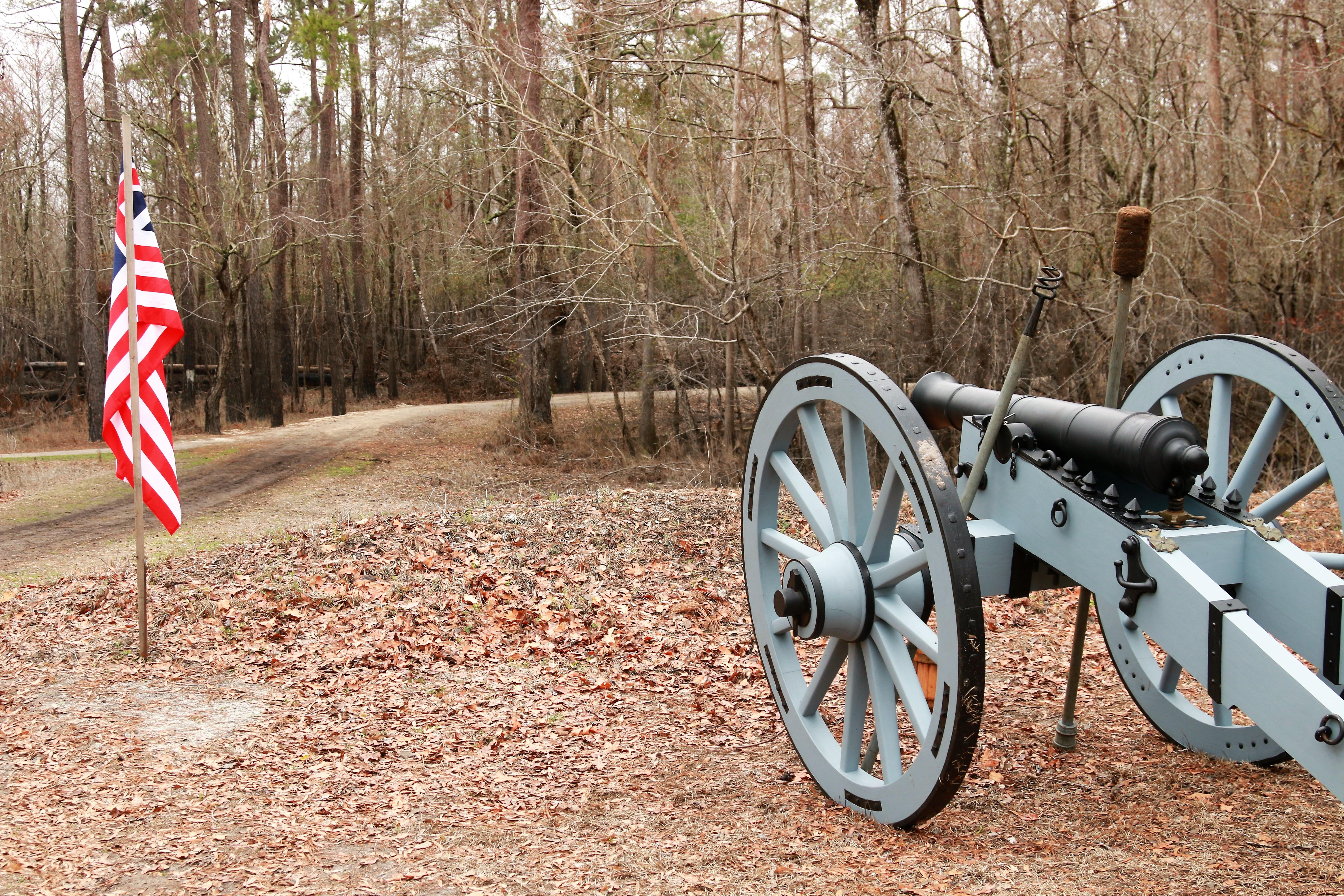
Moores Creek National Battlefield
National Battlefield
In the early morning hours of February 27, 1776, Loyalist forces charged across a partially dismantled Moores Creek Bridge. Beyond the bridge, nearly 1,000 North Carolina Patriots waited quietly with...
Park data from the National Park Service API. Alerts update every 2 hours.
More Details
What kind of drive is this?
This is a 3h 40m highway drive covering 187.4 miles, with most of the trip on I 40 and US 64. The longest continuous stretch is about 85.2 miles on I 40.
Most of the miles stay on highways, which makes pacing and fuel planning easier than turn-by-turn city driving.
There are about 26 navigation steps in the underlying route data, so the final approach matters more than the middle miles.
I 40 is the longest continuous segment at about 85.2 miles.
How Hard Is This Drive?
10/10
This is a straightforward highway drive that stays mostly on I 40 and US 64. This route has several spots where lane changes, forks, or exits need your full attention. The trickiest moment comes around 112 miles in.
Driving Effort10/10
High effort - long or complex enough to need steady focus all day
Balances navigation complexity with total wheel time.
This is a demanding drive. With 21 significant decision points across 187.4 miles, you will need to stay alert - especially through interchange areas and urban stretches. Consider splitting it into segments if you are not comfortable with fast highway navigation.
Where does it get tricky?
The main spots that need attention: at 112 miles: Highway fork - watch signs carefully. Lane positioning matters here; at 170.2 miles (US 421): Exit ramp - move to the correct lane early. Lane positioning matters here. Multiple destination signs - pick the right one; at 170.4 miles (US 421): Highway fork - watch signs carefully. Lane positioning matters here. Multiple destination signs - pick the right one.
Towns Mentioned on Route Signs
Based on OSRM destination-sign hints, not a full list of every settlement the road passes.
Between Burgaw, NC and High Point, NC, road signs point toward Pittsboro, Durham and Charlotte.
High Point is part of the Piedmont Triad in North Carolina, along with Greensboro and Winston-Salem. High Point is often referred to as the furniture capital of the world due not only to the large number of furniture manufactures in the area, but also because of the International Home Furnishings Markets held each spring and fall. Over 8 million square feet of showroom space is used to draw over 70,000 people from all over the world to each market. This nearly doubles the population of High Point resulting in an economic boom to the entire Triad Area as hotel and motel rooms sell out and many residents rent out rooms, floors, or even their entire home for all or part of the 7 to 10 days during the market period.
Doable as a same-day drive at 3h 40m. Total distance: 187.4 miles.
Family Friendly
Moderate complexity with 1 natural rest stops along the way.
Solo Traveler
3h 40m drive, comfortable solo distance.
First-Time Driver
Mostly highway driving (79%). Some complex stretches to watch for.
Frequently Asked Questions
The drive from Burgaw, NC to High Point, NC covers 187.4 miles and takes about 3h 40m without stops. Add 15-30 minutes for a fuel or rest stop on longer drives.
The main roads are I 40, US 64, Isaac Brooks Highway. Most of the drive stays on highways, so watch for ramps and exits.
This is a comfortable same-day trip.
The midpoint is about 93.7 miles from Burgaw, NC. Look for rest areas, gas stations, or food options near the halfway mark.
At current regular gas prices, expect to spend about $29.31 one way. This estimate uses 25.4 MPG — your actual cost will vary with your vehicle's fuel efficiency and current gas prices.
An early start around 7-8 AM gets you there with plenty of daylight left. A late afternoon start means arriving after dark. Morning is better.
Plan about 1 meaningful break for fuel, food, or rest. A short stop every 2 to 3 hours is enough for this drive.
This is a demanding drive. With 21 significant decision points across 187.4 miles, you will need to stay alert - especially through interchange areas and urban stretches. Consider splitting it into segments if you are not comfortable with fast highway navigation.
The main spots that need attention: at 112 miles: Highway fork - watch signs carefully. Lane positioning matters here; at 170.2 miles (US 421): Exit ramp - move to the correct lane early. Lane positioning matters here. Multiple destination signs - pick the right one; at 170.4 miles (US 421): Highway fork - watch signs carefully. Lane positioning matters here. Multiple destination signs - pick the right one.
Between Burgaw, NC and High Point, NC, road signs point toward Pittsboro, Durham and Charlotte.
Yes. Nearby national parks include Moores Creek National Battlefield.
How this page is built
Compiled by the Trip.ovh planning team at COD Solutions Oy from open government datasets — OSRM over OpenStreetMap for geometry, EIA for fuel prices, NREL for EV charging, and NPS for national parks. See our methodology for refresh cadence and limitations.