Trip from Kings Beach, CA to Los Angeles, CA

Drive Time

9h 18m

Distance

497.3 mi

800 km

Drive Score

7/10

Good drive

Same Day?

2-day trip

Fuel Cost

$115

one way

Downtown Los Angeles, CA, CA

Photo: Stephen Leonardi

Trip Overview

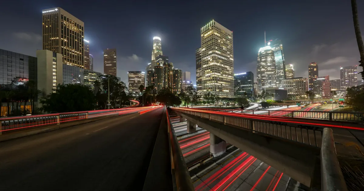
Driving from Kings Beach to Los Angeles covers 497.3 miles and requires about 9 hours and 18 minutes of actual seat time. Because this journey spans nearly 500 miles, it is best approached as a two-day trip rather than a single marathon haul. You will primarily rely on the Westside Freeway, the Alan S. Hart Freeway, and the I-5 Truck route to navigate the state. Budgeting approximately $68 for fuel is a smart way to prepare for the costs ahead. While both ends of your trip are located within the Pacific Coast region, the sheer scale of this drive makes planning for at least two stops essential to maintain your focus and comfort behind the wheel.

Trip Pace

Best split across 2 days

Treat the return leg as its own travel day rather than an afterthought.

Break Rhythm

2 planned breaks

Plan on a short reset every 3 to 4 hours to stay fresh behind the wheel.

Midpoint

248.7 miles from Kings Beach, CA

A natural place for your longest stop of the day , about 4h 42m into the drive .

Drive Character

Expect a highly efficient, highway-focused experience, as 97% of your travel occurs on major thoroughfares. The personality of this route is defined by consistency and speed, prioritizing direct transit over secondary roads. You should prepare for a significant stretch of open road, specifically a 296.3-mile segment along the Westside Freeway that serves as the backbone of your journey. As you progress from the Tahoe area toward Southern California, the landscape transitions from mountain surroundings to the industrial and agricultural corridors serviced by the I-5 system. It is a functional, no-nonsense drive designed for those who need to cover ground quickly and reliably.

Most of the miles stay on highways, which makes pacing and fuel planning easier than turn-by-turn city driving.
There are about 29 navigation steps in the underlying route data, so the final approach matters more than the middle miles.
Westside Freeway is the longest continuous segment at about 296.3 miles.

How Hard Is This Drive?

This is a straightforward highway drive that stays mostly on Westside Freeway and Alan S. Hart Freeway. This route has several spots where lane changes, forks, or exits need your full attention. The trickiest moment comes around 104.3 miles in near I 80 Business / Capital City Freeway.

Route Complexity 9/10

High effort - long or complex enough to need steady focus all day

This is a demanding drive. With 22 significant decision points across 497.3 miles, you will need to stay alert — especially through interchange areas and urban stretches. Consider splitting it into segments if you are not comfortable with fast highway navigation.

Where does it get tricky?

The main spots that need attention: at 104.3 miles (I 80 Business / Capital City Freeway): Highway fork - watch signs carefully. Lane positioning matters here; at 112.9 miles (I 80 Business / Capital City Freeway): Highway fork - watch signs carefully. Lane positioning matters here. Multiple destination signs - pick the right one; at 114.9 miles: Exit ramp - move to the correct lane early. Lane positioning matters here. Multiple destination signs - pick the right one.

Critical Maneuvers

5 of 22 key points

These are the spots where you need to pay the most attention. Preview them before you drive.

8
104.3 mi into trip | ~2h 5m in | I 80 Business / Capital City Freeway

Keep slight right at fork onto I 80 Business / Capital City Freeway toward I 80 Business West: Sacramento

Highway fork - watch signs carefully. Lane positioning matters here

Use the straight / slight right lanes. Exit 95 Toward I 80 Business West: Sacramento
8
112.9 mi into trip | ~2h 14m in | I 80 Business / Capital City Freeway

Keep slight right at fork onto I 80 Business / Capital City Freeway toward US 50 East, I 80 West: South Lake Tahoe, San Francisco

Highway fork - watch signs carefully. Lane positioning matters here. Multiple destination signs - pick the right one

Use the straight / slight right lanes. Toward US 50 East, I 80 West: South Lake Tahoe,...
8
114.9 mi into trip | ~2h 16m in

Take the exit toward I 5: Los Angeles, Redding

Exit ramp - move to the correct lane early. Lane positioning matters here. Multiple destination signs - pick the right one

Use the straight / slight right lanes. Exit 4A Toward I 5: Los Angeles, Redding
8
115 mi into trip | ~2h 16m in

Keep slight left at fork toward I 5 South: Los Angeles

Highway fork - watch signs carefully. Lane positioning matters here

Use the slight left lane. Exit 4A Toward I 5 South: Los Angeles
8
474.5 mi into trip | ~8h 49m in | I 5 Truck

Keep slight right at fork onto I 5 Truck toward I 405 South

Highway fork - watch signs carefully. Lane positioning matters here

Use the straight / slight right lanes. Exit 158 Toward I 405 South

Towns Along This Route

Between Kings Beach, CA and Los Angeles, CA, road signs point toward San Francisco and Redding.

San Francisco

112.9 mi in | ~2h 14m | via I 80 Business

Redding

114.9 mi in | ~2h 16m

Main Roads

Road Distance Duration
Westside Freeway 296.3 mi 5h 19m
Alan S. Hart Freeway 84.2 mi 1h 37m
I 5 Truck 63.9 mi 1h 13m
Hollywood Freeway 16.2 mi 20m
Capital City Freeway 10.6 mi 11m
Dwight D. Eisenhower Highway 7.1 mi 8m
California Highway 267 5.8 mi 8m
Senator Paul J. Lunardi Memorial Highway 5.2 mi 7m
Longest stretch: Westside Freeway — 296.3 mi, about 5h 19m

Turn-by-Turn Driving Directions

Step-by-step road directions between Kings Beach, CA and Los Angeles, CA.

1

114 ft · 9 sec · Trout Avenue
2

77 ft · 5 sec · Deer Street
3

0.2 mi · 40 sec · CA 28
4

0.6 mi · 1 min · CA 267
5

5.2 mi · 7 min · CA 267
6

5.8 mi · 8 min · CA 267
7

0.2 mi · 20 sec · CA 89
8

0.9 mi · 1 min · CA 89
Toward CA 89
9

84 mi · 1 hr 37 min · I 80; CA 89
Use the none / slight right lanes.
10

7.1 mi · 8 min · I 80
Use the none / straight / slight right lanes.
11

4.9 mi · 5 min · I 80 Business
Exit 95 Toward I 80 Business West: Sacramento Use the straight / slight right lanes.
12

3.7 mi · 4 min · I 80 Business
Use the none / straight / slight right lanes.
13

1.9 mi · 2 min · I 80 Business
Toward US 50 East, I 80 West: South Lake Tahoe, San Francisco Use the straight / slight right lanes.
14

0.2 mi · 15 sec
Exit 4A Toward I 5: Los Angeles, Redding Use the straight / slight right lanes.
15

0.8 mi · 1 min
Exit 4A Toward I 5 South: Los Angeles Use the slight left lane.
16

59 mi · 1 hr 5 min · I 5
Use the none / straight / slight right lanes.
17

0.8 mi · 48 sec · I 5
18

237 mi · 4 hr 13 min · I 5
Use the none / straight / slight right lanes.
19

58 mi · 1 hr 6 min · I 5 Truck
Use the none / straight / slight right lanes.
20

4.1 mi · 4 min · I 5
Use the none lane.
21

0.3 mi · 17 sec · I 5 Truck
Exit 158 Toward I 405 South Use the straight / slight right lanes.
22

5.3 mi · 6 min · I 5 Truck
Use the straight / slight right lanes.
23

0.5 mi · 32 sec
Exit 153B Toward CA 170 South: Hollywood Use the straight / slight right lanes.
24

16 mi · 20 min · CA 170
Use the none lane.
25

0.1 mi · 17 sec
Exit 2C Toward Broadway Use the straight / slight right lanes.
26

409 ft · 18 sec · West Aliso Street
Use the straight lane.
27

0.3 mi · 35 sec · North Spring Street
Use the right lane.
28

354 ft · 12 sec · West 1st Street
Use the left lane.
29

West 1st Street

Trip Plan

To manage this 497.3-mile trek effectively, aim to break the drive into two manageable days, allowing you to pace yourself without feeling rushed. With two planned stops integrated into your itinerary, you can easily handle the long hours while staying refreshed. Given the heavy reliance on high-speed freeways, keep a close eye on your fuel gauge during that long 296.3-mile stretch on the Westside Freeway, as services can be spaced out. Departing early in the morning is your best strategy to avoid the worst of the congestion as you approach the Los Angeles metropolitan area. Use these two suggested stops not just for fuel, but as deliberate opportunities to stretch your legs and reset before tackling the final miles of your trip.

Morning Departure

Start early — leave by 6-7 AM to arrive at a reasonable hour.

Evening Departure

This is a long drive — plan for a morning departure or consider splitting it into two days.

This drive is better paced as a 2-day trip.
Plan roughly 2 meaningful breaks for fuel, food, and rest.
The halfway point lands around 248.7 miles from Kings Beach, CA, or about 4h 42m into the drive.
The longest continuous stretch on this route runs about 296.3 miles.

Consider an overnight stop or starting very early.

Departure

Before you leave

Start with fuel, water, and navigation already sorted so the first hour feels easy.

First stop

Around 109 miles or 2h 10m in

Use this first pause for coffee, a restroom break, and a quick traffic check ahead.

Halfway reset

Around 248.7 miles or 4h 42m in

This is the best place for your longest stop, a real meal, and a full fuel check.

Overnight split

Day 1 wrap after about 248.7 miles or 4h 42m

Stop before fatigue turns the last few hours into a grind. You want day two to start fresh, not just resumed.

Final approach

Final hour starts around 8h 6m

Traffic, exits, and arrival timing usually matter more near Los Angeles, CA than in the middle of the route.

Before You Leave

+

Open the route before leaving Kings Beach, CA so your first major turns are already loaded.

+

Leave with enough water and a charging cable within reach, not packed away.

+

Check your fuel range against the first long segment, especially if you are starting outside city service areas.

+

Pick one backup stop option before the midpoint in case traffic changes your pacing.

+

Treat this as a 2-day road trip and book the overnight stop before the busiest arrival window.

Day 1

Settle into the route from Kings Beach, CA

Aim for roughly 249 miles and 4.7 hours of wheel time on this day.

Day 2

Finish the approach into Los Angeles, CA

Aim for roughly 249 miles and 4.7 hours of wheel time on this day.

Your first comfortable stop window is around 109 miles from Kings Beach, CA.
This route usually feels better as a 2-day drive than as one long push.
Plan about 2 real breaks rather than only quick fuel stops.
The longest stretch is on Westside Freeway for about 296.3 miles.

Where to Stop

Rest stops, refuel points, and overnight suggestions along this route.

Halfway Point

Midpoint

About 248.7 mi from Kings Beach, CA · 4h 42m into the drive

Downtown Laguna, CA, CA

Mid-route town

Overnight candidate

Laguna, CA

249 mi into the route

Best for: Hotel check-in, dinner, and a fresh start

This lines up well with a realistic day-end stop if you are breaking the drive into stages.

Find hotels in Laguna, CA

Popular next leg

Laguna, CA to Los Angeles, CA

373.9 mi · 6h 57m

Overnight Options

Night 1

Laguna, CA

249 mi · about 4.7h in

A practical overnight split lands near Laguna, CA after about 249 miles or 4.7 hours of driving.

Find hotels

Pacing Suggestions

Sacramento, CA

Fuel and coffee

A short stop after about 109 miles helps settle the day before fatigue starts building.

Turlock, CA

Meal break

The midpoint is around 248.7 miles from Kings Beach, CA, which is a good place for a longer meal and fuel stop.

Before the longest stretch

Fuel check

Top up before Westside Freeway if your tank is already low. That segment runs about 296.3 miles.

Overnight split

Hotel stop

For a steadier pace, wrap day one after about 249 miles or 4.7 hours on the road.

Arriving in Los Angeles, CA

The final approach into Los Angeles, CA usually feels slower than the middle of the drive, so avoid planning your tightest schedule at the very end.

Try to arrive with enough fuel left to skip an immediate station stop unless you already know the area around Los Angeles, CA.

On a multi-day trip, keep the last day a little lighter so you reach Los Angeles, CA with some flexibility left in the schedule.

After long uninterrupted mileage, take five minutes before the last urban segment to reset and refocus on exits, merges, and city traffic.

These stop ideas are pacing suggestions — the exact town or exit can change with traffic, hotel plans, and fuel range.

Fuel & Cost

Regular Gas

$115.16 one way

$230.32 round trip

$5.88/gal 25.4 MPG avg 174 kg CO2
Fuel Type $/gal One Way Round Trip
midgrade $3.85 $75.38 $150.76
premium $4.15 $81.25 $162.50
diesel $5.64 $110.48 $220.97

No toll roads detected on this route.

Estimated Trip Cost (one way, 1 person)

Fuel

$115

Hotel (1n)

$80–$140

Meals

$50–$100

Total

$245–$355

Rough estimate based on US averages. Hotel $80–$140/night, meals $25–$50/day.

Estimated CO2 emission: 174 kg one way. Prices: EIA weekly data, 2026-04-06.

Driving Electric?

About $52 in charging · 1 stop · 67% less CO2

Vehicle Type kWh Stops DC Fast Home Charge
Average EV 149.2 1 $52.22 $23.87
Efficient EV 124.3 1 $43.51 $19.89
EV Truck/SUV 198.9 2 $69.62 $31.83

Gas CO2

174 kg

EV CO2

58 kg (67% less)

Plan for 1 charging stop. A 30-minute DC fast charge mid-route should be enough to complete the trip comfortably.

DC fast charging avg $0.35/kWh. Home charging avg $0.16/kWh. US grid CO2: 0.39 kg/kWh.

Travel Intel

Local time and weather at both ends of the drive

Current conditions at both ends of the drive. If you're planning ahead, check the forecast closer to your travel date.

Forecast data refreshed 1 day ago

Origin

Kings Beach, CA

Afternoon in Kings Beach on Saturday

Local time

12:49 PM

PDT

Current temp

51°F

Forecast unavailable right now

PDT Live forecast

Destination

Los Angeles, CA

Afternoon in Los Angeles on Saturday

Local time

12:49 PM

PDT

Current temp

77°F

Forecast unavailable right now

PDT Live forecast

Along the Route

72°F

Laguna, CA

249 mi in

Seasonal Notes

Summer travel usually means heavier construction, hotter rest stops, and busier weekend traffic around major cities.

Winter travel shortens daylight, so a route that looks manageable on paper can feel much longer after dark.

Holiday weekends tend to make both departure and arrival windows slower than the raw route time suggests.

For long drives, weather on day two can matter just as much as conditions at departure, so check the whole travel window rather than only the first day.

Time zone

Same local time

Origin and destination are on the same clock, so arrival timing is easier to judge at a glance.

Temperature spread

26 degrees warmer at arrival

A meaningful temperature swing is a good cue to rethink layers, water, and how soon you want to arrive.

Road read

9h 18m on the road

This is long enough that the arrival forecast matters almost as much as departure conditions. Recheck both ends before you roll.

Frequently Asked Questions

The drive from Kings Beach, CA to Los Angeles, CA covers 497.3 miles and takes about 9h 18m without stops. Add 15-30 minutes for a fuel or rest stop on longer drives.
The main roads are Westside Freeway, Alan S. Hart Freeway, I 5 Truck. Most of the drive stays on highways, so watch for ramps and exits.
Consider an overnight stop or starting very early.
Yes. This route is usually more comfortable as a 2-day drive. A sensible stopping point is after roughly 249 miles on day one.
The midpoint is about 248.7 miles from Kings Beach, CA. Look for rest areas, gas stations, or food options near the halfway mark.
At current regular gas prices, expect to spend about $115.16 one way. This estimate uses 25.4 MPG — your actual cost will vary with your vehicle's fuel efficiency and current gas prices.
Start early — leave by 6-7 AM to arrive at a reasonable hour. This is a long drive — plan for a morning departure or consider splitting it into two days.
Plan about 2 meaningful breaks for fuel, food, or rest. Plan on a short reset every 3 to 4 hours to stay fresh behind the wheel.
This is a demanding drive. With 22 significant decision points across 497.3 miles, you will need to stay alert — especially through interchange areas and urban stretches. Consider splitting it into segments if you are not comfortable with fast highway navigation.
The main spots that need attention: at 104.3 miles (I 80 Business / Capital City Freeway): Highway fork - watch signs carefully. Lane positioning matters here; at 112.9 miles (I 80 Business / Capital City Freeway): Highway fork - watch signs carefully. Lane positioning matters here. Multiple destination signs - pick the right one; at 114.9 miles: Exit ramp - move to the correct lane early. Lane positioning matters here. Multiple destination signs - pick the right one.
Between Kings Beach, CA and Los Angeles, CA, road signs point toward San Francisco and Redding.

Was this route helpful?

Thanks for your feedback!

Your tip has been submitted. Thanks!

/500

Explore More

Explore more options from Kings Beach, CA or browse trips ending in Los Angeles, CA.

Looking for more statewide routes? Browse CA road trips.

Explore maps for Kings Beach, CA or Los Angeles, CA on MapSof.net.