Trip from Lone Pine, CA to Los Angeles, CA

Drive Time

4h 3m

Distance

209 mi

336 km

Drive Score

9/10

Great drive

Same Day?

Yes, doable

Fuel Cost

$48

one way

Downtown Los Angeles, CA, CA

Photo: Stephen Leonardi

Trip Overview

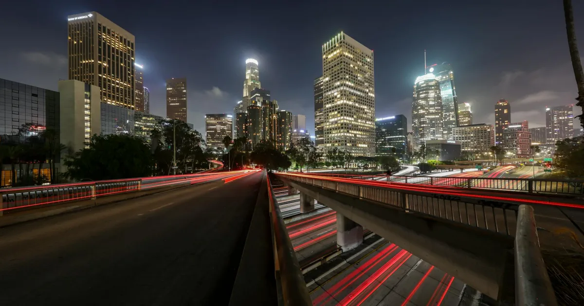
Driving from Lone Pine to Los Angeles covers 209 miles and typically takes about 4 hours and 3 minutes. This route serves as a perfect one-day trip, allowing you to transition from the Eastern Sierra region down into the heart of the Pacific Coast. You will navigate via the Grand Army of the Republic Highway, the Antelope Valley Freeway, and the Aerospace Highway. With an estimated fuel cost of $28, the journey is quite budget-friendly for a solo driver or a small group. Whether you are heading back to the city or exploring the region, this drive provides a straightforward connection between two distinct California landscapes. It is a manageable distance that does not require an overnight stay, keeping your travel plans simple and efficient.

Trip Pace

Same-day drive is realistic

A same-day return is possible, but it will make for a full day on the road.

Break Rhythm

1 planned break

Plan on a short reset every 3 to 4 hours to stay fresh behind the wheel.

Midpoint

104.5 miles from Lone Pine, CA

A natural place for your longest stop of the day , about 2h 2m into the drive .

Drive Character

This trip features a mixed drive profile that keeps the experience varied behind the wheel. You will spend roughly 35% of your time on highways, balancing open stretches with more localized road navigation. The longest uninterrupted portion of the journey spans 56.1 miles along the Grand Army of the Republic Highway, which provides a steady rhythm before the route transitions toward the city. As you move from the mountain-adjacent areas toward the Los Angeles basin, the road character shifts from regional thoroughfares to busier freeway corridors. Expect a blend of high-speed cruising and standard roadway driving that reflects the shifting terrain as you approach your destination.

Expect a mix of faster highway mileage and slower local approaches near the beginning or end.
There are about 23 navigation steps in the underlying route data, so the final approach matters more than the middle miles.
Grand Army of the Republic Highway is the longest continuous segment at about 56.1 miles.

How Hard Is This Drive?

This route mixes highway mileage with some local-road sections near the start or finish. This route has several spots where lane changes, forks, or exits need your full attention. The trickiest moment comes around 186.2 miles in near I 5 Truck.

Route Complexity 7/10

Demanding - plan breaks and stay ahead of the key maneuvers

This is a demanding drive. With 14 significant decision points across 209 miles, you will need to stay alert — especially through interchange areas and urban stretches. Consider splitting it into segments if you are not comfortable with fast highway navigation.

Where does it get tricky?

The main spots that need attention: at 186.2 miles (I 5 Truck): Highway fork - watch signs carefully. Lane positioning matters here; at 191.8 miles: Exit ramp - move to the correct lane early. Lane positioning matters here; at 208.5 miles: Exit ramp - move to the correct lane early. Lane positioning matters here.

Critical Maneuvers

5 of 14 key points

These are the spots where you need to pay the most attention. Preview them before you drive.

8
186.2 mi into trip | ~3h 34m in | I 5 Truck

Keep slight right at fork onto I 5 Truck toward I 405 South

Highway fork - watch signs carefully. Lane positioning matters here

Use the straight / slight right lanes. Exit 158 Toward I 405 South
7
191.8 mi into trip | ~3h 40m in

Take the exit toward CA 170 South: Hollywood

Exit ramp - move to the correct lane early. Lane positioning matters here

Use the straight / slight right lanes. Exit 153B Toward CA 170 South: Hollywood
7
208.5 mi into trip | ~4h 2m in

Take the exit toward Broadway

Exit ramp - move to the correct lane early. Lane positioning matters here

Use the straight / slight right lanes. Exit 2C Toward Broadway
7
208.7 mi into trip | ~4h 2m in | North Spring Street

Turn right onto North Spring Street

Lane positioning matters here

Use the right lane.
7
208.9 mi into trip | ~4h 3m in | West 1st Street

Turn left onto West 1st Street

Lane positioning matters here

Use the left lane.

Main Roads

Road Distance Duration
Grand Army of the Republic Highway 56.1 mi 1h 4m
Antelope Valley Freeway 49.1 mi 54m
Aerospace Highway 42.1 mi 47m
Midland Trail 22 mi 25m
Hollywood Freeway 16.2 mi 20m
Blue Star Memorial Highway 7 mi 8m
I 5 Truck 5.6 mi 6m
Sierra Highway 4.7 mi 6m
Longest stretch: Grand Army of the Republic Highway — 56.1 mi, about 1h 4m

Turn-by-Turn Driving Directions

Step-by-step road directions between Lone Pine, CA and Los Angeles, CA.

1

78 ft · 10 sec · North Washington Street
2

296 ft · 16 sec · West Bush Street
3

1.9 mi · 3 min · US 395; US 6 Hist
Use the none lane.
4

56 mi · 1 hr 4 min · US 395; US 6 Hist
Use the straight lane.
5

7.0 mi · 8 min · US 395; US 6 Hist
Use the straight lane.
6

6.4 mi · 7 min · CA 14; US 6 Hist
Use the slight left / slight right lanes.
7

22 mi · 25 min · CA 14; CA 178; US 6 Hist
8

20 mi · 23 min · CA 14; US 6 Hist
Use the none lane.
9

4.7 mi · 6 min · CA 14; CA 58 BUS; US 6 Hist
Use the left lane.
10

16 mi · 16 min · CA 14
Use the none / straight / slight right lanes.
11

48 mi · 53 min · CA 14; CA 138
Use the none / straight / slight right lanes.
12

1.0 mi · 1 min · CA 14
Use the none / straight / slight right lanes.
13

0.5 mi · 36 sec
Use the none / straight / slight right lanes.
14

2.6 mi · 3 min · I 5
Use the none lane.
15

0.3 mi · 17 sec · I 5 Truck
Exit 158 Toward I 405 South Use the straight / slight right lanes.
16

5.3 mi · 6 min · I 5 Truck
Use the straight / slight right lanes.
17

0.5 mi · 32 sec
Exit 153B Toward CA 170 South: Hollywood Use the straight / slight right lanes.
18

16 mi · 20 min · CA 170
Use the none lane.
19

0.1 mi · 17 sec
Exit 2C Toward Broadway Use the straight / slight right lanes.
20

409 ft · 18 sec · West Aliso Street
Use the straight lane.
21

0.3 mi · 35 sec · North Spring Street
Use the right lane.
22

354 ft · 12 sec · West 1st Street
Use the left lane.
23

West 1st Street

Trip Plan

Plan for at least one dedicated stop to stretch your legs and break up the four-hour journey. Since the route is relatively short, you have the flexibility to depart early in the morning or mid-day to avoid peak traffic congestion as you enter the Los Angeles area. Keep a close eye on your fuel gauge during the initial stretch, as services may be spaced out before you hit the more populated sections of the Antelope Valley Freeway. Since your fuel budget is approximately $28, consider filling up in Lone Pine to ensure you have plenty of range for the 209-mile trek. Prioritize comfort and consistency, as the variety of road types means you should remain alert to changing speed limits throughout the drive.

Morning Departure

An early start around 7-8 AM gets you there with plenty of daylight left.

Evening Departure

A late afternoon start means arriving after dark. Morning is better.

You can normally do this drive in one day.
Plan roughly 1 meaningful break for fuel, food, and rest.
The halfway point lands around 104.5 miles from Lone Pine, CA, or about 2h 2m into the drive.
The longest continuous stretch on this route runs about 56.1 miles.

This is a comfortable same-day trip.

Departure

Before you leave

Start with fuel, water, and navigation already sorted so the first hour feels easy.

First stop

Around 80 miles or 1h 34m in

Use this first pause for coffee, a restroom break, and a quick traffic check ahead.

Halfway reset

Around 104.5 miles or 2h 2m in

This is the best place for your longest stop, a real meal, and a full fuel check.

Final approach

Final hour starts around 3h 17m

Traffic, exits, and arrival timing usually matter more near Los Angeles, CA than in the middle of the route.

Before You Leave

+

Open the route before leaving Lone Pine, CA so your first major turns are already loaded.

+

Leave with enough water and a charging cable within reach, not packed away.

+

Check your fuel range against the first long segment, especially if you are starting outside city service areas.

Day 1

Settle into the route from Lone Pine, CA

This is one driving day of about 209 miles and 4h 3m.

Your first comfortable stop window is around 80 miles from Lone Pine, CA.
This route can stay practical as a one-day drive if traffic stays reasonable.
Plan about 1 real break rather than only quick fuel stops.
The longest stretch is on Grand Army of the Republic Highway for about 56.1 miles.

Where to Stop

Rest stops, refuel points, and overnight suggestions along this route.

Halfway Point

Midpoint

About 104.5 mi from Lone Pine, CA · 2h 2m into the drive

Downtown Lancaster, CA, CA

Mid-route town

Meal stop

Lancaster, CA

105 mi into the route

Best for: Lunch, fuel, and a longer reset

This sits close to the middle of the route, so it works well for the longest stop of the day.

Popular next leg

Lancaster, CA to Los Angeles, CA

70.8 mi · 1h 25m

Pacing Suggestions

Lancaster, CA

Fuel and coffee

A short stop after about 80 miles helps settle the day before fatigue starts building.

Lancaster, CA

Meal break

The midpoint is around 104.5 miles from Lone Pine, CA, which is a good place for a longer meal and fuel stop.

Arriving in Los Angeles, CA

The final approach into Los Angeles, CA usually feels slower than the middle of the drive, so avoid planning your tightest schedule at the very end.

Try to arrive with enough fuel left to skip an immediate station stop unless you already know the area around Los Angeles, CA.

These stop ideas are pacing suggestions — the exact town or exit can change with traffic, hotel plans, and fuel range.

Fuel & Cost

Regular Gas

$48.40 one way

$96.80 round trip

$5.88/gal 25.4 MPG avg 73 kg CO2
Fuel Type $/gal One Way Round Trip
midgrade $6.07 $49.91 $99.83
premium $6.24 $51.37 $102.74
diesel $5.64 $46.43 $92.87

No toll roads detected on this route.

Estimated Trip Cost (one way, 1 person)

Fuel

$48

Meals

$25–$50

Total

$73–$98

Rough estimate based on US averages. Hotel $80–$140/night, meals $25–$50/day.

Estimated CO2 emission: 73.1 kg one way. Prices: EIA weekly data, 2026-04-06.

Driving Electric?

About $22 in charging · 0 stops · 67% less CO2

Vehicle Type kWh Stops DC Fast Home Charge
Average EV 62.7 0 $21.94 $10.03
Efficient EV 52.3 0 $18.29 $8.36
EV Truck/SUV 83.6 1 $29.26 $13.38

Gas CO2

73 kg

EV CO2

24 kg (67% less)

This trip is well within single-charge range for most EVs. No charging stops needed if you start fully charged.

DC fast charging avg $0.35/kWh. Home charging avg $0.16/kWh. US grid CO2: 0.39 kg/kWh.

Travel Intel

Local time and weather at both ends of the drive

Current conditions at both ends of the drive. If you're planning ahead, check the forecast closer to your travel date.

Forecast data refreshed 1 day ago

Origin

Lone Pine, CA

Afternoon in Lone Pine on Saturday

Local time

12:57 PM

PDT

Current temp

48°F

Forecast unavailable right now

PDT Live forecast

Destination

Los Angeles, CA

Afternoon in Los Angeles on Saturday

Local time

12:57 PM

PDT

Current temp

77°F

Forecast unavailable right now

PDT Live forecast

Along the Route

74°F

Lancaster, CA

105 mi in

Seasonal Notes

Summer travel usually means heavier construction, hotter rest stops, and busier weekend traffic around major cities.

Winter travel shortens daylight, so a route that looks manageable on paper can feel much longer after dark.

Holiday weekends tend to make both departure and arrival windows slower than the raw route time suggests.

Time zone

Same local time

Origin and destination are on the same clock, so arrival timing is easier to judge at a glance.

Temperature spread

29 degrees warmer at arrival

A meaningful temperature swing is a good cue to rethink layers, water, and how soon you want to arrive.

Road read

4h 3m on the road

An early start around 7-8 AM gets you there with plenty of daylight left.

Frequently Asked Questions

The drive from Lone Pine, CA to Los Angeles, CA covers 209 miles and takes about 4h 3m without stops. Add 15-30 minutes for a fuel or rest stop on longer drives.
The main roads are Grand Army of the Republic Highway, Antelope Valley Freeway, Aerospace Highway. Expect a mix of highway and local road driving.
This is a comfortable same-day trip.
The midpoint is about 104.5 miles from Lone Pine, CA. Look for rest areas, gas stations, or food options near the halfway mark.
At current regular gas prices, expect to spend about $48.40 one way. This estimate uses 25.4 MPG — your actual cost will vary with your vehicle's fuel efficiency and current gas prices.
An early start around 7-8 AM gets you there with plenty of daylight left. A late afternoon start means arriving after dark. Morning is better.
Plan about 1 meaningful break for fuel, food, or rest. Plan on a short reset every 3 to 4 hours to stay fresh behind the wheel.
This is a demanding drive. With 14 significant decision points across 209 miles, you will need to stay alert — especially through interchange areas and urban stretches. Consider splitting it into segments if you are not comfortable with fast highway navigation.
The main spots that need attention: at 186.2 miles (I 5 Truck): Highway fork - watch signs carefully. Lane positioning matters here; at 191.8 miles: Exit ramp - move to the correct lane early. Lane positioning matters here; at 208.5 miles: Exit ramp - move to the correct lane early. Lane positioning matters here.
The route from Lone Pine, CA to Los Angeles, CA does not surface many named destination signs beyond the main corridor.

Was this route helpful?

Thanks for your feedback!

Your tip has been submitted. Thanks!

/500

Explore More

Explore more options from Lone Pine, CA or browse trips ending in Los Angeles, CA.

Looking for more statewide routes? Browse CA road trips.

Explore maps for Lone Pine, CA or Los Angeles, CA on MapSof.net.