The drive from Marionville, MO to Independence, MO covers 191.6 miles and takes about 3h 48m behind the wheel.
This route is realistic as a one-day drive if you keep your stops efficient.
The route leans on Purple Heart Trail, I 44, Trooper Charles P. Corbin Memorial Highway for much of the mileage,
and the overall profile is turn-heavy local drive.
The longest uninterrupted segment is about 92.9 miles on Purple Heart Trail.
At current regular gas prices, budget about $29.95 one way before food or hotel costs.
Trip Pace
Same-day drive is realistic
A same-day return is realistic if you keep stops short.
Break Rhythm
1 planned break
A short stop every 2 to 3 hours is enough for this drive.
Midpoint
95.8 miles from Marionville, MO
A natural place for your longest stop of the day
, about 1h 51m into the drive
.
Who Is This Route For?
Weekend Trip
Doable as a same-day drive at 3h 48m. Total distance: 191.6 miles.
Family Friendly
Moderate complexity with 1 natural rest stops along the way.
Solo Traveler
3h 48m drive, comfortable solo distance.
Scenic Drive
Turn-heavy local drive route profile with national parks nearby.
Drive Character
Expect a 3h 48m drive with frequent turns across 191.6 miles of local and secondary roads.
This route has more turning and local-road decision points than a simple highway run.
There are about 27 navigation steps in the underlying route data, so the final approach matters more than the middle miles.
Purple Heart Trail is the longest continuous segment at about 92.9 miles.
How Hard Is This Drive?
Expect a hands-on drive with frequent turns and local roads rather than long highway stretches. You will hit about 17 points where you need to pay attention to lane position or signs. The trickiest moment comes around 45.8 miles in.
Driving Effort6/10
Moderate - straightforward overall, but long enough or busy enough to require pacing
Balances navigation complexity with total wheel time.
This drive requires moderate attention. Across 191.6 miles you will encounter 17 spots where lane choice or exit timing matters. Not difficult for experienced highway drivers, but worth previewing the tricky sections before you go.
Where does it get tricky?
The main spots that need attention: at 45.8 miles: Exit ramp - move to the correct lane early. Multiple destination signs - pick the right one; at 159.9 miles: Exit ramp - move to the correct lane early; at 160.1 miles: Highway fork - watch signs carefully.
Critical Maneuvers
5 of 17 key points
These are the spots where you need to pay the most attention. Preview them before you drive.
6
45.8 mi into trip|~58m in
Take the exit toward I 49 North, US 71 North: Carthage, Kansas City
Exit ramp - move to the correct lane early. Multiple destination signs - pick the right one
Exit 18B
Toward I 49 North, US 71 North: Carthage, Kansa...
5
159.9 mi into trip|~3h in
Take the exit toward MO 291 North: Lee's Summit
Exit ramp - move to the correct lane early
Exit 160
Toward MO 291 North: Lee's Summit
6
160.1 mi into trip|~3h in
Keep slight right at fork toward MO 291 North: Lee's Summit
Highway fork - watch signs carefully
Toward MO 291 North: Lee's Summit
5
177.1 mi into trip|~3h 25m in
Take the exit toward US 50 West: Kansas City
Exit ramp - move to the correct lane early
Toward US 50 West: Kansas City
5
191.4 mi into trip|~3h 47m in|South Lynn Street
Turn right onto South Lynn Street
Navigation decision point
Towns Mentioned on Route Signs
Based on OSRM destination-sign hints, not a full list of every settlement the road passes.
On the drive from Marionville, MO to Independence, MO, road signs begin pointing toward Kansas City along the way.
The midpoint is around 95.8 miles from Marionville, MO, which is a good place for a longer meal and fuel stop.
Before the longest stretch
Fuel check
Top up before Purple Heart Trail if your tank is already low. That segment runs about 92.9 miles.
Arriving in Independence, MO
The final approach into Independence, MO usually feels slower than the middle of the drive, so avoid planning your tightest schedule at the very end.
Try to arrive with enough fuel left to skip an immediate station stop unless you already know the area around Independence, MO.
These stop ideas are pacing suggestions — the exact town or exit can change with traffic, hotel plans, and fuel range.
National Parks Near This Route
Worth a detour if your schedule allows.
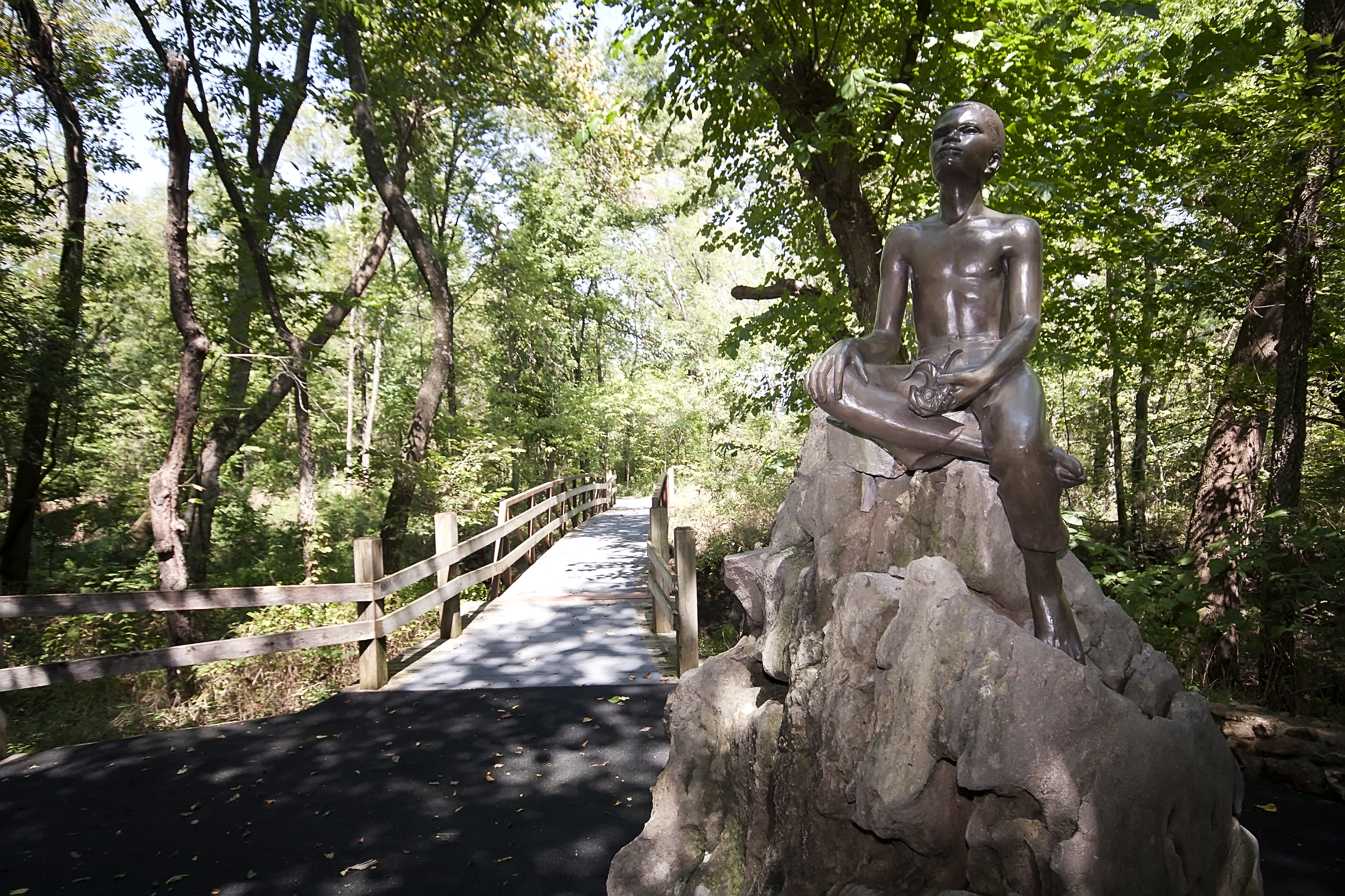
George Washington Carver National Monument
National Monument
The young child known as the "Plant Doctor" tended his secret garden while observing the day-to-day operations of a 19th century farm. Nature and nurture ultimately influenced George on his quest for...
7 mi from route
~18 min detour
Free
near mile 46.2
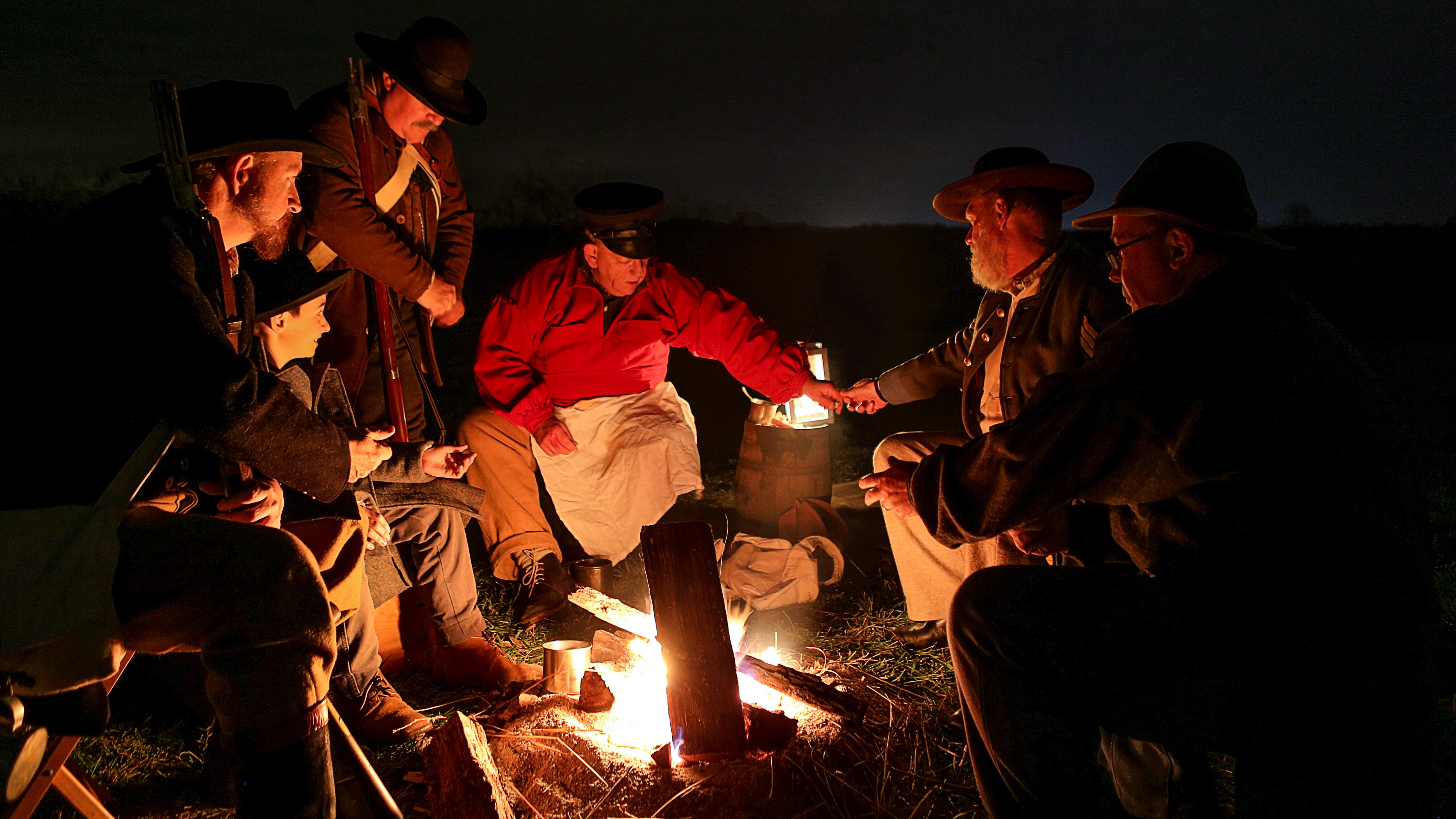
Wilson's Creek was the first major Civil War battle fought west of the Mississippi River, and where the first Union general was killed in action. The costly Southern victory on August 10, 1861, focuse...
Park data from the National Park Service API. Alerts update every 2 hours.
Fuel & Cost
Regular Gas
$29.95 one way
$59.91 round trip
$3.97/gal25.4 MPG avg67 kg CO2
Fuel Type
$/gal
One Way
Round Trip
midgrade
$4.36
$32.89
$65.78
premium
$4.89
$36.87
$73.74
diesel
$5.61
$42.30
$84.61
No toll roads detected on this route.
Estimated Trip Cost (one way, 1 person)
Fuel
$30
Meals
$25–$50
Total
$55–$80
Rough estimate based on US averages. Hotel $80–$140/night, meals $25–$50/day.
Estimated CO2 emission: 67 kg one way.
Prices: EIA weekly data, 2026-04-13.
Driving Electric?
About $20 in charging
· 0 stops
· 67% less CO2
Vehicle Type
kWh
Stops
DC Fast
Home Charge
Average EV
57.5
0
$20.12
$9.20
Efficient EV
47.9
0
$16.76
$7.66
EV Truck/SUV
76.6
0
$26.82
$12.26
Gas CO2
67 kg
EV CO2
22 kg (67% less)
This trip is well within single-charge range for most EVs. No charging stops needed if you start fully charged.
DC fast charging avg $0.35/kWh. Home charging avg $0.16/kWh. US grid CO2: 0.39 kg/kWh.
Travel Intel
Current conditions at both ends of the drive.
Forecast as of Apr 15, 2026
Origin
Marionville, MO
Late night
in Marionville on Saturday
Local time
12:57 AM
CDT
Current temp
54°F
Unavailable
Live forecast
Destination
Independence, MO
Late night
in Independence on Saturday
Local time
12:57 AM
CDT
Current temp
73°F
Unavailable
Live forecast
73°F
Nevada, MO
96 mi in
Seasonal Notes
Summer travel usually means heavier construction, hotter rest stops, and busier weekend traffic around major cities.
Winter travel shortens daylight, so a route that looks manageable on paper can feel much longer after dark.
Holiday weekends tend to make both departure and arrival windows slower than the raw route time suggests.
Time zone
Same local time
Origin and destination are on the same clock, so arrival timing is easier to judge at a glance.
Temperature spread
19 degrees warmer at arrival
A meaningful temperature swing is a good cue to rethink layers, water, and how soon you want to arrive.
Road read
3h 48m on the road
Use the two city cards together: check the sky where you start, then compare it with the local time and temperature at arrival.
Weather data from the National Weather Service. Conditions may change; check closer to your travel date.
Frequently Asked Questions
The drive from Marionville, MO to Independence, MO covers 191.6 miles and takes about 3h 48m without stops. Add 15-30 minutes for a fuel or rest stop on longer drives.
The main roads are Purple Heart Trail, I 44, Trooper Charles P. Corbin Memorial Highway. Expect a mix of highway and local road driving.
This is a comfortable same-day trip.
The midpoint is about 95.8 miles from Marionville, MO. Look for rest areas, gas stations, or food options near the halfway mark.
At current regular gas prices, expect to spend about $29.95 one way. This estimate uses 25.4 MPG — your actual cost will vary with your vehicle's fuel efficiency and current gas prices.
An early start around 7-8 AM gets you there with plenty of daylight left. A late afternoon start means arriving after dark. Morning is better.
Plan about 1 meaningful break for fuel, food, or rest. A short stop every 2 to 3 hours is enough for this drive.
This drive requires moderate attention. Across 191.6 miles you will encounter 17 spots where lane choice or exit timing matters. Not difficult for experienced highway drivers, but worth previewing the tricky sections before you go.
The main spots that need attention: at 45.8 miles: Exit ramp - move to the correct lane early. Multiple destination signs - pick the right one; at 159.9 miles: Exit ramp - move to the correct lane early; at 160.1 miles: Highway fork - watch signs carefully.
On the drive from Marionville, MO to Independence, MO, road signs begin pointing toward Kansas City along the way.
Yes. Nearby national parks include George Washington Carver National Monument and Wilson's Creek National Battlefield.
How this page is built
Compiled by the Trip.ovh planning team at COD Solutions Oy from open government datasets — OSRM over OpenStreetMap for geometry, EIA for fuel prices, and NPS for national parks. See our methodology for refresh cadence and limitations.